With these maps, you can easily discover the best hiking trails and activities in South Tyrol. Get an overview of where everything is located and quickly find nearby destinations for your next adventure.
Interactive Map of Hikes and Activities in South Tyrol
Hikes
Outdoor Activities
Indoor Activities
Click on the icon on the map to access filter options. 
Simply click on the pin to view the main details of the destination. A second click will take you directly to the specific hike or activity.
Regions of South Tyrol
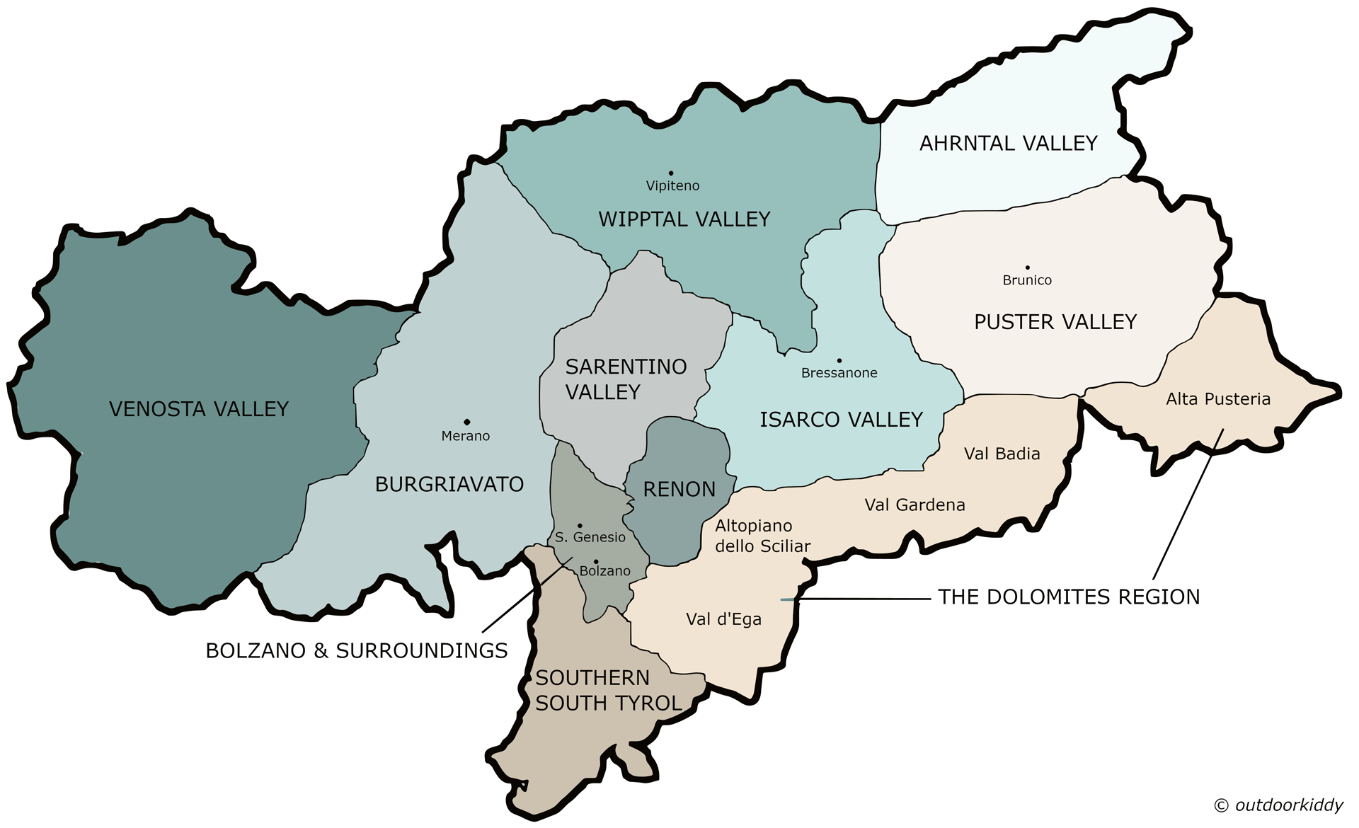
- Venosta Valley: The western part of South Tyrol, from the Resia Pass to Naturno
- Burgraviato: Around the town of Merano and its surrounding region
- Southern South Tyrol: South of Bolzano, extending to Salorno
- Bolzano and Surroundings: Around the city of Bolzano and nearby towns (e.g. San Genesio, Laives)
- Renon Plateau: A high plateau northeast of Bolzano
- Sarentino Valley: A valley north of Bolzano
- The Dolomites Region: Includes Val d’Ega, Altopiano dello Sciliar, Val Gardena, Val Badia, and Alta Pusteria
- Isarco Valley: Along the Isarco River, from Fortezza through Chiusa to Ponte Gardena, just before Bolzano
- Wipptal Valley: From Fortezza to the Brenner Pass
- Puster Valley: East of Mühlbach, extending through Brunico to San Candido and Sillian
- Ahrntal Valley: A side valley of the Puster Valley, from Campo Tures to Predoi